Mount Toubkal — The Big One
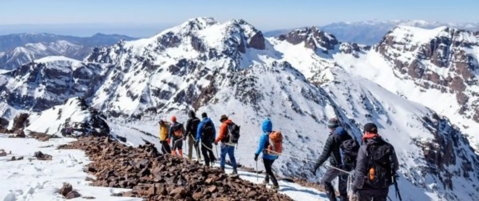
Jebel Toubkal stands at 4,167 metres — summit it on our 3-day Toubkal ascent tour — the highest point in North Africa, the second highest in Africa after Kilimanjaro. From Marrakech it takes 90 minutes by car to reach Imlil, the village at the foot of the mountain. From Imlil the summit is two days away at a normal pace, with a night at the CAF refuge at 3,207 metres.
This is not a technical climb. There is no rock climbing and no ropes required in summer (May to November). The route follows a well-marked trail up the Mizane valley to the refuge, then a long scree slope to the summit the following morning. The difficulty is physical rather than technical — 1,900 metres of climbing on Day 2, most of it on loose rock. Good fitness and proper footwear are not optional.
In winter (December to April) the route requires crampons and ice axe experience. The summit views in winter — snow-covered Atlas in every direction, the Sahara visible as a faint brown horizon to the south on clear days — are extraordinary. The summer version is more crowded but more accessible.
Ourika Valley — Easy Atlas Hiking
The Ourika Valley is one hour south of Marrakech — full Ourika Valley guide here — and the most accessible mountain hiking in the region. The valley follows the Oued Ourika river into the High Atlas, with the trail to the Setti Fatma waterfalls as the main hiking destination.
From the village of Setti Fatma at the end of the road, the path climbs to seven waterfalls in sequence. The first waterfall is 45 minutes uphill — the most dramatic and the one most visitors reach. A rope assists on the steeper section near the top. The seventh waterfall, reached by continuing for another two hours, is smaller but the trail through the higher valley is quieter and more rewarding.
Difficulty: Easy to moderate. Suitable for most fitness levels.
Good shoes essential — the path is uneven stone throughout.
Best season: March to May and September to November. The valley
stays cool even in summer.
Distance: 4 to 6 km return depending on how far you go.
Imlil and the Ait Misane Valley
Imlil at 1,740 metres is the gateway to Toubkal but also a destination in its own — accessible on our Imlil day trip right. The Ait Misane valley above the village offers excellent half-day and full-day walks through walnut orchards, Berber villages and mountain farmland without requiring any summit ambitions.
The walk to the village of Armed (1,905m) takes 45 minutes uphill from Imlil and gives a panoramic view of the surrounding massif. From Armed, continuing to the marabout of Sidi Chamharouch at 2,350m adds another hour — a dramatic boulder with a shrine built against it, where local Berbers come to pray for healing.
The Aroumd circuit — a loop through several villages above Imlil — takes a full day and covers about 15 kilometres with 600 metres of altitude gain. A guide from the village association is recommended but not strictly necessary on the main paths.
Difficulty: Easy (village walks) to moderate (Sidi Chamharouch).
Best season: April to June and September to November. Snow covers
the upper paths from December to March.
Saturday tip: The weekly souk at Asni (15km before Imlil) is on
Saturdays — worth combining with an Imlil day.
Want a guided day in Imlil or a 3-day Toubkal ascent? We organise both from Marrakech.
See Toubkal Trek →Ouzoud Waterfalls Trail
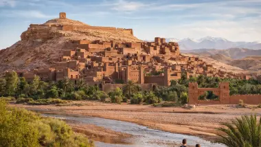
The Ouzoud trail is less of a mountain hike and more of a descent — the main path drops through olive and almond groves from the parking area to the base of the falls, a 110-metre cascade that is the highest in North Africa. The walk down takes 20 minutes on stone steps; the walk back up is the same in reverse, slightly more effort.
For hikers who want more, there is a longer route that follows the Oued el-Abid river upstream from the base of the falls for several kilometres through the gorge. The gorge section is cool even in summer and the Barbary macaques that live in the surrounding cliffs are more frequently seen away from the main tourist area.
Difficulty: Easy. The main path is accessible for all fitness levels.
The river gorge extension requires sure footing on slippery rocks.
Distance from Marrakech: 150 km, approximately 2.5 hours.
Desert Hiking near Merzouga and M'Hamid
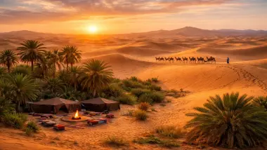
Desert hiking is a different kind of walking — flat, hot, directionally confusing, and genuinely extraordinary. The dunes of Erg Chebbi near Merzouga reach 150 metres. Walking up a 150-metre sand dune in the pre-dawn dark to catch the sunrise is one of the more physical things most Morocco visitors do, and also one of the most memorable.
For longer desert treks, the area around M'Hamid and Erg Chegaga is the most rewarding. The landscape here alternates between sandy ergs, rocky hammada plateaux, dry river beds and occasional palm oases. Walking with a local Berber guide between camps — one or two hours per session, the rest of the time by camel or 4x4 — is the most common format and works well even for non-hikers.
The Draa Valley between Zagora and M'Hamid also offers excellent walking — the route along the palmeries follows the Draa river through a succession of ancient ksour and Berber villages, largely unchanged by tourism. A half-day walk from Zagora towards Tamegroute covers some of the best of this landscape.
Difficulty: Easy (dune sunrise climb) to moderate (multi-day desert trek).
What to bring: Headscarf against sand, sunscreen factor 50+, at least
2 litres of water per person per hour of walking, light shoes (sandals work for dunes,
proper shoes for hammada).
Best Seasons for Hiking in Morocco
April to June — best overall
The Atlas is green, wildflowers are out, temperatures are comfortable at altitude and the Sahara has not yet reached its summer extremes. The most reliable window for Toubkal, Ourika and Atlas hikes. Ouzoud falls are at full volume.
September to November — second best
Similar to spring but slightly drier. Toubkal is less crowded than in July and August. The desert cools to comfortable temperatures. October is the best month for desert hiking.
December to March — winter hiking
Snow on Toubkal from December — crampons required, more demanding but extraordinary. The Ourika valley walks are accessible year-round. Desert hiking is excellent in winter — cold nights but warm days and no crowds.
July and August — avoid for serious hiking
Toubkal is busy and hot on the lower sections. Desert hiking becomes dangerous in the middle of the day. The Ourika valley is cooler than Marrakech and still viable. For serious mountain hiking, this is the weakest season.
What to Bring
Footwear: Ankle-support hiking boots for Toubkal and Imlil. Sturdy trainers for Ourika. Light sandals work for Ouzoud and desert dune walking.
Layers: The Atlas temperature drops 6 to 7°C per 1,000 metres. A morning at Imlil (1,740m) feels noticeably cooler than Marrakech. Above 3,000m, a windproof layer is essential even in summer.
Water: 2 litres minimum for a half-day mountain hike. More for desert walking. There are water sources at Imlil and the Toubkal refuge but nothing reliable above.
Sun protection: UV intensity is significantly higher at altitude. Sunscreen and a hat are not optional above 2,000m, even in cloudy conditions.
Guides: Required for Toubkal (certified mountain guide recommended for safety and logistics). Optional but useful for Imlil valley walks and desert treks. Available through the local guide association in Imlil village.